High winds dominated today's weather across much of NM. Below is the predicted peak surface winds at 21 UTC (3 pm MDT) today showing the highest winds in the northeastern part of our region.
GOES visible at 21 UTC (3 pm) today with predicted wind vectors from RUC mode
Here are some peak winds from the airport weather stations across the region today
gust visibility time
Location mph winds miles MDT
Las Cruces KLRU 48 SW32 5 16:11
Deming KDMN 44 W 29 3 15:53
El Paso KELP 41 SW 26 10 16:51
Alamogordo KELM 43 SW 20 9 14:30
Las Cruces KLRU 48 SW32 5 16:11
Deming KDMN 44 W 29 3 15:53
El Paso KELP 41 SW 26 10 16:51
Alamogordo KELM 43 SW 20 9 14:30
At the NMED monitoring sites we saw high PM concentrations. Below are the hourly PM10 and PM2.5 concentrations at the Sunland Park City Yard station. Peak hourly PM10 was 638 ug/m3 at 3 pm.
At the Anthony Elementary site we also saw high concentrations Peak hourly PM10 at this site reached 778 ug.m3 at 4 pm.
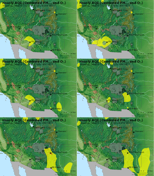
An animated EPA AQI map shows the extent of the dust event based on their interpolation scheme.


No comments:
Post a Comment