Sunday, May 30, 2010

May 30

Warm and toasty today with high of 93 in LC and Deming, and 96 in Santa Teresa. No MODIS Rapidfire images today so here is afternoon GOES.


MODIS AOD shows some elevated column aerosol over the Gila again today in the morning. Not too informative for the other areas.


I think the main item to look for is smoke from the Gila and subsequent transport to other areas. Based on the Deming profiler the transport direction aloft is a northwest wind below 3 km bringing air from the NW toward the SE bringing smoke out of the Gila and into areas south. See the profiler ladder plot from 3 am (09 UTC) to 11 pm (05 UTC) to prove my point. Above 3 km winds show more west-southwest wind. The Santa Teresa NEXRAD VAD product shows the shear at little lower down, around 1.5 to 1.6 km above the surface.


The NOAA air quality smoke forecast also predict this as well. The map below is a forecast for surface smoke concentrations at 11 pm on May 30. Concentrations are mainly perceptible in El Paso County and southeast Dona Ana County at 11 pm. The Sunland Park City Yard showed some high PM to possibly confirm this with a PM2.5/PM10 ratio of around 0.27 or so. Not so obvious in Chaparral with PM10 around 40 to 50 ug/m3 but higher than what I would expect with not much wind. At 11 pm the Anthony site is showing PM2.5/PM10 ratio of 0.22 with PM10 at 64 ug/m3. The Holman Road LC site is showing PM10 of about 50 ug/m3 with very light easterly winds.

Right now the RUC shows northwesterly winds out of the Gila and some easterly winds across eastern Dona Ana County. It pretty much nails the Holman Road wind direction on the head. See the RUC20 surface wind vector map below from 06 UTC.

It will interesting to see the visibility in the morning after things have settled in the Valley.

Saturday, May 29, 2010

May 29

Nice warm day, clear across the border with some thunderstorms in the east over the Sacramento Mountains. Dewpoints getting lower compared to yesterday. High of 93 F in Las Cruces and Deming. Afternoon MODIS image here proves that.

MODIS AOD shows a little elevated column aerosol in central mid-state in the morning.

In the afternoon AOD looks a little higher even although cloud cover masks most of the eastern part of the state.


According to AirNow the southwest border region area was green today. An area of moderate AQI was seen in the eastern part of the state probably due to ozone. Most of the air quality issues are due to smoke from fires. The Horseshoe fire in southeastern Arizona at 1,100 acres could be blowing smoke into New Mexico overnight and into early morning. The NOAA/EPA predictions show this as shaded areas in the map below.

Friday, May 28, 2010

May 28

Still under attack from the humid air but not as bad as yesterday. Dewpoints finally below 40 F. Thunderstorms again were fired up from the moisture and instability by the afternoon. No precipitation on campus but some toward the west and over the Sacramento mountains to the east. MODIS morning image from Terra showed building convection early in the day, first up north then down south.


MODIS morning view showed some elevated AOD in the south. However visibility was pretty good this afternoon. Afternoon MODIS AOD not useful.


The elevated AOD may be from smoke from burning in the Gila based on the NOAA HMS smoke and fire map (below).

Evening thunderstorm activity still has the possibility for stirring up dust down south particularly during short lived outflow.


Seeing high PM10 and PM2.5 at Sunland Park Desert View site and somewhat at Anthony. Surprisingly not at Sunland Park City Yard. Based on the 2009 study there were episodes where Desert View was impacted more then the sites further east in Sunland Park.

Ozone was elevated along the border with the Santa Teresa site winning with the highest hourly ozone at 72 ppb at 3 pm. The other Sunland Park sites reached 69 ppb. The EPA AirNow showed a yellow area in this region in the afternoon.

Wednesday, May 26, 2010

May 26

Hazy and humid start to the day. Dewpoints were high most of the day with moist air mass boundary well into central NM. Day started off clear but convective clouds started to grow by late morning and thunderstorms in the afternoon over the mountains and to the east. I could feel the moist air mass come into Las Cruces around 10 am or so. Afternoon MODIS image below shows there spotted convective cells throughout the state.

MODIS AOD showed elevated particulates over the central part of the state and into west Texas.

By evening convective storms were producing outflow winds. These winds were high enough to blow dust around starting in the Paso del Norte region. GOES IR and mesonet maps show these outflow wind patterns nicely.

Outflow from these winds are from the east where the blue regions of storms.

The outflow winds reached the Las Cruces area between 8-10 pm but weren't that strong. By the way these convective clouds were fairly deep with cloud tops around 35,000 feet. In the evening before the sun went down I was looking at these tops and they showed the nice anvil structure fanning out after reaching the tropopause at around 10 km.

Dust was flying at all of the Paso del Norte sites with Sunland Park City Yard PM10 at 168 ug/m3 with 13 m/s maximum winds from the SE direction at 10 pm. These high PM values triggered yellow AQI (moderate level) in the AirNow maps. As of 6 pm we were right under the dryline and is still in the same place at 9 pm.

Another observation was the presence of bugs. I don't know if there was a good correlation but there seemed more bugs outside right around the time of the outflow.

May 24 and 25

May 24

Only reached 79 F as a high in Las Cruces and 78 in Deming. North part of state, temperatures dipped below freezing in the higher terrain. Thunderstorms again in the eastern part of state in the early morning left over from yesterday. The afternoon MODIS Aqua image below shows clear skies over the state with fire locations in red.


Carlsbad wildfire continues with smoke plume moving northeast away from our area. NOAA HMS showed fire still burning south of NM bootheel but very little smoke. Can also see wildfire at the NM/CO border with a more substantial smoke plume.


May 25

Warm up from yesterday with high of 86 in Las Cruces and 85 in Deming. Clear skies today with most of the weather in the eastern part of the state in the afternoon. Lots of severe weather as predicted with reports of hail (up to golf ball size) and a tornado. The forecast map below shows the area of severe thunderstorms covering all of eastern edge of NM.


The dewpoint map at 9 pm shows the clear boundary between the dry and moist air across the state (below) and surface weather map at 9 pm with dryline location in orange and warm front in red across southeast corner of CO.


Fires are still burning west of Carlsbad (>13,000 acres) and a prescribed burn in the Gila. The Gila burn is called the Powder Horn Lat: 33.0942, Long: 108.0239, at up to 1000 acres per day


MODIS AOD didn't a lot of detail today. Rough observations outside showed good visibility. Ozone in Deming peaked around 50 ppb, 56 ppb in Sunland Park-Desert View, and 58 ppb in Sunland Park-City Yard. For particulates, there looks to be a low wind event at the Sunland Park City Yard tonight (see plot below).

PM10 peaked at 240 ug/m3 tonight and PM2.5 peaked at around 50 ug/m3. Winds were 1 m/s from the SW at 11 pm. PM was also elevated at the Anthony site but not as high, PM10 at 150 ug/m3 and PM2.5 at 20 ug/m3.

Sunday, May 23, 2010

May 21,22 and 23

Got behind in posts due to interesting weather and air quality over the past weekend. No internet access as well, since I was on the road on the 21 and 22.

May 21

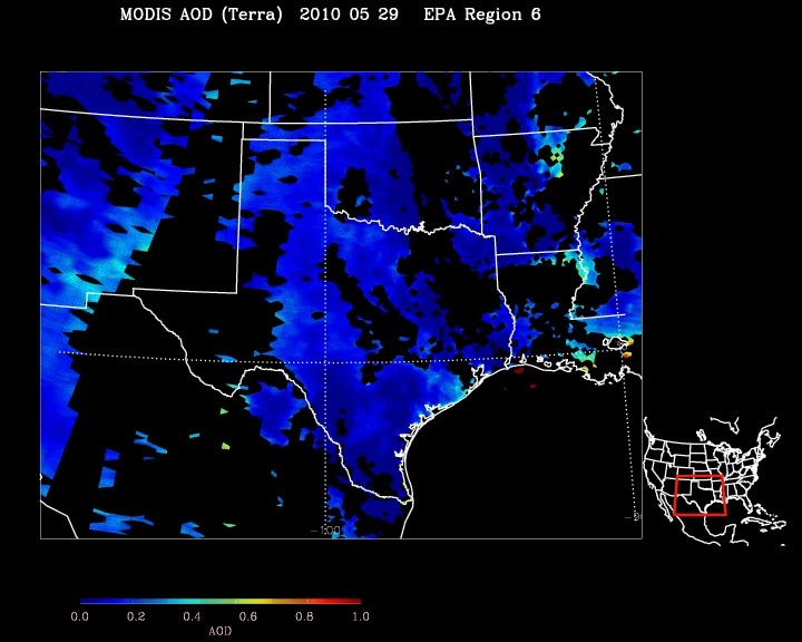
Another fair weather day, with temperatures above normal. Forecast called for high winds over the weekend but mainly over the northern part of the state. Still some possibility for dust in the southern part of the state. Today's MODIS Terra below.

However the story of the day is the hay fire in Mesquite, NM. This fire was burning stored hay at the Del Norte Dairy and was reported shortly before 3 am. The morning air in the Souterh Mesilla Valley was filled with this smoke plume. Looking from Las Cruces in the morning the plume top was below the Franklin Mountains showing an inversion keeping the plume fairly low to the ground.

I was tempted to spend the weekend up at the Four Corners to get some experience with the ceilometer during a dust storm and look at the dust source up by Mexican Springs. I finally gave into the temptation and spent the afternoon preparing for the trip. Left around 8:30 pm to get at least to the Albuquerque area for the night. I spent the night at my parent's place up in the Sandia Mountains south of Tijeras. It's the perfect place to just crash in the middle of the night with just a sleeping bag.

May 22

Left camp and got to Gallup around noon. Saw a large dust plume as I was approaching Thoreau. That's about 30 miles from the dust plume. I travelled up on hwy 491 toward Shiprock. I didn't get far. It was amazing. I don’t know how people cope with this type of environment. Fortunately it doesn't happen too often at this magnitude. This photo was taken at the Bahastla Chapter House near Twin Lakes around noon looking north. Visibility was around 100 feet just past where this was taken. I didn't continue through the plume since it was too dangerous but people were driving as normal.


Since I didn't want to drive through this I took the long way around the plume and took off for Window Rock and come around through Narbona Pass. I also thought that going up to the top I can see the extent of the dust plume and see where I can take measurements.

The next photo was taken near the Washington Pass lookout tower at about an elevation of 9300 feet looking northeast toward Farmington. The dust plume top was about the height of the peak or maybe a little higher.


Points west of the the Chuska Mountains were clear, with not much dust. After taking a little side trip to see if my relatives were home just below this area. Nobody home so I headed down the mountain toward Sheep Springs and continue north on 491. I again didn't get far. Hit an intense dust area and decided to stay put and find a place to take measurements just south of Newcomb. I found one road that nobody has used and pulled off the road. Made sure to get off the road enough so that nobody thought I was on the road. I stayed there for a couple of hours until 6 pm. Got a couple of good hours of ceilometer measurments. Most of the backscatter was below 100 meters but sometimes it was 200 to 300 meters. I was right at the dust source so I don't expect the heights to be more than couple hundred meters anyway. Mainly interested in maximum signal and its height. The ceilometer worked right through the most intense dust storm that I've been in. The optic window was almost covered in dust by the end of the day. Making a note of this for the future. The separate deep cycle battery with 750W inverter worked great. I ran the laptop with a separate inverter in the truck. Even one second of that dust to a laptop will destroy it. I also found massive static discharge in the dust storm. That might cause problems with computers but not sure. I think it would be good to try to get downwind backscatter profiles the next time but that calls for more planning to see where the plume is going and finding a safe route in getting there. The photo below was a typical view during the dust storm at the ceilometer location.


left that location at about 6:30 pm after the winds had subsided just a little and was safe to get back on the highway. Driving back it was clear to see how the dust sources varied by type of land disturbance and vegetation cover. Having been to these areas before there are areas that have been grazed until there is nothing growing. There's probably some soil differences but I think most of the issue is level of disturbance over the years. The areas with vegetation had very little dust compared to the unvegetated lots. These are large lots of 100s of acres. A few places in hwy 491 had dust covering across the lane on the road and dunes building up on the side. Arrived back in Las Cruces at 12:30 am Sunday. A very long day.

May 23

Another nice sunny and breezy day but not much dust as observed in Las Cruces. Most of the border area had above normal temperatures. Las Cruces hit 88 at the airport. Carlsbad hit 97 today. A fire south of the bootheel of NM was burning today. Based on NOAA HMS product the smoke plume was travelling northeast toward Luna County. I think the actual fire was located in Mexico but close to the US border.


Winds continued up the northwest part of the state. Winds peaked at 48 mph in Gallup. Thunderstorms are an issue today and tonight in the eastern part of the state. Looking at the dewpoints, there's a huge gradient in western Chaves and extreme eastern Otero County. Upper level trof moves in to the area so temperatures should drop down a bit. Airnow is predicting yellow ozone for Monday for the border area. We'll wait and see.

Friday, May 21, 2010

May 20

Another mild day in the southwest. Sunny with high in Las Cruces of 88 F, and 89 in Deming. Nice clear MODIS Aqua image here.

Similar to yesterday, afternoon MODIS AOD were higher than morning estimates. Higher AOD over west central NM in the afternoon maybe from prescribed burning. According to the SWCC website, there is a prescribed fire in the Black Range from 5/20 to 5/25, burning up to 4000 acres per day.


Storm system coming in this weekend bringing in windy conditions. The bigger story is up north in the Four Corners and into NE Arizona. Calling for another dust storm event with strong southwest winds. Below is NAM-12km prediction for 10-meter wind speed tomorrow afternoon (0:00 UTC). Darkest red is 30 mph.


A different story for the Four Corners. Same model but contour range changed to max of 40 mph. So the dust sources are probably going to blowing lots of dust again tomorrow afternoon and a repeat for the weekend.

Wednesday, May 19, 2010

May 19

Nice sunny and uneventful air quality day. Some wind in the afternoon but not enough for dust. See this afternoon's MODIS Aqua true-color image. Northern NM had some cloud cover but very little near the border.

I didn't see any nearby fires or smoke plumes from the NOAA HMS mapping today.

Looking at MODIS AOD from the morning Terra (top) and comparing it to the afternoon Aqua (bottom), we see interesting differences mainly along the Rio Grande River Valley. AOD is higher in the morning and low in the afternoon.


There is an interesting news article about the dust problem on I-40 in Arizona. It is a big problem and ADOT is attempting to fix it. We'll see what they end up doing. I do know that the area surrounding the dust source has not seen rain for quite a while.

http://www.azjournal.com/news/126/ARTICLE/5568/2010-05-19.html

May 17 and 18

May 17

There was a Sunland Park low wind event on the 17th. See the plot on left.

The Desert View site (right plot) also saw this event as well although not as much as Sunland Park. It was interesting to see the Anthony site seeing this a little bit in the plot below.

I'll need to look at little more into the extent of the low wind events at a later time.
The 17th ended with some haze in the afternoon. Winds were from the south so not sure what the source was. MODIS AOD was higher than usual but only showed up in the center of the state along the Rio Grande Valley.


May 18

Warm day in southern NM, high of 88 today in Las Cruces. High of 86 in Deming. Would have been higher but probably the high cloud cover depressed it a bit. It was windy in the afternoon but didn't notice a lot of dust here in Las Cruces looking out the window. Winds in Las Cruces were out of W to SW in the afternoon. MODIS AOD in the afternoon showed some high numbers.

There was a lot of clouds, so I'm not too confident on those numbers. Satellite based fire detection didn't see any fires in So. NM but might be because of cloud cover. In the evening the dryline is set up in eastern NM, so we might see a migration toward central NM overnight. Not sure. Winds are still from W-WNW at midnight and dewpoint gradient is still way over in eastern side of state so it might not. EPA AQI forecast for the border is green so don't see any major regional problems. Some wind tomorrow but probably not above too problematic. But we'll wait and see.

Sunday, May 16, 2010

May 16

Warm and dry weather under ridge of high pressure over the borderland today. High of 84 in Las Cruces airport (KLRU). Clouds were building up over the Organ Mountains but I didn't see any precipitation. This afternoon's MODIS Aqua image shows our nice day with some convection over our area. Most of the precipitation in southern NM probably fell over the Sacramento Mountains and Sierra Blanca.

For fires, the Willow prescribed burn continued today. Winds take the plume northward into Grant County and toward the Gila Wilderness.

No major aerosols based on GASP aerosol optical depth. The MODIS AOD didn't show a product in our area. Lost of burning in Mexico along the west coast.

Looking at the local air quality data, there was a low wind high PM event in Sunland Park late last night and early this morning. PM10 reached about 391 ug/m3 and PM2.5 hit 76 ug/m3 and lasted about 4 hours. The 6 am sounding at Santa Teresa showed a strong stable layer.

From the observations at 9 pm, it looks like there might be another low wind event there tonight. I'll report on this tomorrow.