

Below is the 21 UTC (2 pm) surface winds showing the peak winds across an area that runs NW to NE.

The NWS is forecasting westerly winds in the range of 19 to 20 mph with gusts up to 31 mph.
The AQI forecast is showing good air quality for all of New Mexico.

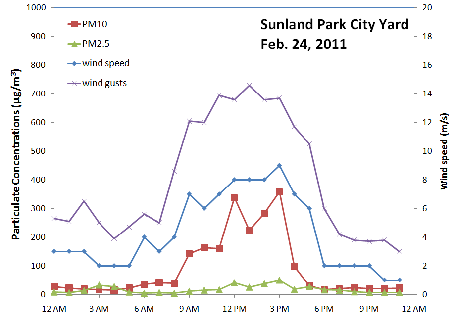
By late morning the Sunland Park City Yard station started to see dust from the high winds. Peak hourly PM10 reached 358 µg/m3 at 3 pm. Peak PM2.5 was 50 µg/m3 at that same hour.

I'm looking at the forecast for this week for possibly a high wind dust event. There are possibilities for dust on both Saturday and Sunday. Sunday looks to be the strongest of the two. Below is the GFS 06Z run showing surface winds on late Sunday morning at 11 am.

No comments:
Post a Comment