

Comparing this with the 12-km NAM we see some differences in the wind magnitudes. The NAM is predicting more momentum than the RUC. The plot below is for the same time as the plot above just the model changed.

Today's AQI forecast is shown below with an area of moderate air quality in West Texas and Paso del Norte.

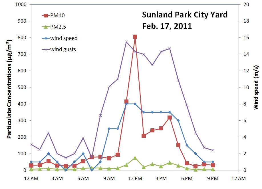
As of 8:30 am air quality is in the good AQI range. Winds are picking up in our region and we're seeing dust in southern Dona Ana County. Below is a plot of PM and winds at the Sunland Park City Yard station up till noon. The noon PM10 sample was 805 µg/m3 and PM2.5 was 75 µg/m3.
Particulates at the Anthony site are increasing as the afternoon progresses.

Winds across the NMED network were the highest a the Deming Airport today. Winds gusts peaked at almost 18 m/s.

The forecast for Friday is shown below.

No comments:
Post a Comment