
A warm day but not a record. Today's high at the NMSU Coop was 95F as of 6 pm tonight. Thunderstorms popped up early in the day over the Sacramento Mountains and by 6 pm, we were feeling the outflow winds in Las Cruces. The NWS had issued several severe weather warnings in Otero County and West Texas.
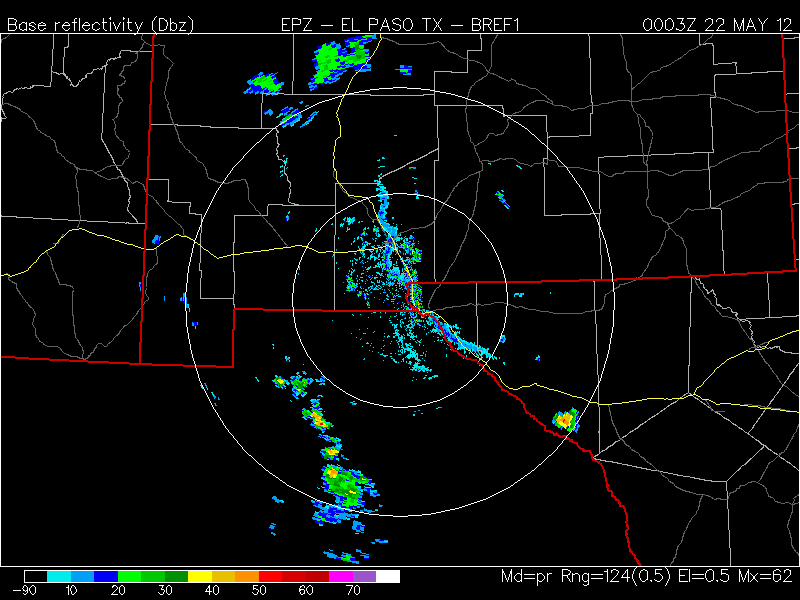
I set out a petri dish to collect fungi suspended in the air from the outflow winds. The highest winds at the station was 19 mph from the east during the sampling. The site is sort of sheltered on campus and obviously it was much higher outside of town. Below is a reflectivity map from the radar showing the line of dust and a few droplets from the outflow (courtesy of College of Dupage).
Wind trajectories for the wildfires in the Gila are pushing smoke toward the northeast and east today. The green lines are forward trajectories from 500 meters and the red ones are from 3 km. Hysplit was run in an ensemble mode to mimic spatial uncertainty. There is a trajectory every 6 hours starting from 5 am this morning.

Winds are expected to increase this week and unlikely to give firefighters a break in controlling the fires here in NM and AZ. The moisture is feeding thunderstorms and could produce lightning over the next couple of days.
No comments:
Post a Comment