
A significant cool air mass has settled over the border region. Highs in the 60 are forecasted over the area as the upper level low slowly creeps toward the east.
The AQI forecast shows an area of moderate over Dona Ana, southwest Otero counties due to ozone. The portion in west Texas is attributed to dust as PM10. The orange colored area over Lubbock is due to wind blown dust that is forecasted for today.

We will again miss out on any precipitation from upper lows passing through the region.The map below shows the 5-day QPF with precipitation falling well north of us in the mountains near Raton.

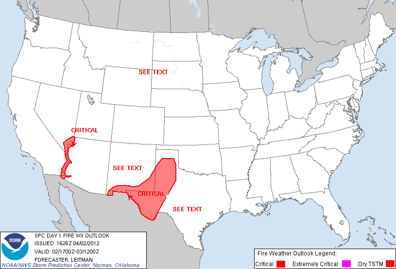
The winds and dry conditions are causing the border region to be included in a fire weather area today.
Winds have increased this afternoon with gusts up to 46 mph at 3:15 pm at the Las Cruces airport. Some blowing dust can be seen across Las Cruces and has caused some haze but overall visibility remains good.
No comments:
Post a Comment