Monday, January 31, 2011

Jan. 29-31 -  Been out of commission due to flu since the 28th. Now to summarize the past weekend.

Jan 29 - low of 26F and a high of 66F today at NMSU

Jan 30 - low of 26F and a high of 65F this afternoon

Jan 31 - High wind PM in the afternoon. The Sunland Park City Yard station peaked around 3 pm today with a with a PM10 concentration of around 2000 µg/m3. PM was high at Chaparral with peal PM10 over 600 µg/m3. We had a low of 27F this morning at the NMSU station. Big story is the approaching winter storm system complete with precipitation, winds, and very cold temperatures. The QPF for tonight through Tuesday night shows likely precipitation in Northern Dona Ana, Sierra Counties. Most of the storm's impact looks to be in the eastern plains of NM but the chances are that we'll get some precipitation either rain or snow in the next couple of days.

Friday, January 28, 2011

Jan. 28 - Low wind high PM episode - Low at NMSU this morning was 23F. The forecast for today looks to be a mild day with low winds and clear skies. Below is the 20 UTC (1 pm MST) surface wind forecast showing winds in the 1 to 4 m/s range throughout the region.
By 10 am (below) we were getting northerly flow in the east and easterly in the west according to the model but the airport observations show calms. The NMED Deming airport winds at 10 am were 1 m/s from the ENE.
This morning's MODIS AOD product showed very little aerosol over the region.
We saw a low wind high PM spike at the Sunland Park City Yard  station tonight. Peak PM10 was 293 µg/m3 and peak PM2.5 was 61 µg/m3.

Thursday, January 27, 2011

Jan. 27 - Low wind high PM event - Mild day with low winds. Morning low at NMSU was 27F and high of 58F.

I drove down to El Paso Community College to hear EPA Administrator Jackson speak on environmental justice this morning. Here is her 5 minute speech below.

I saw a thick low level haze layer as I was driving and became dense as I approached the area around Vado. Some of it was road paving but I think most of it was part of a regional haze layer that continued south on I-10. Below is a video looking south to the meeting around 9:30 am.
 
On the drive back north to Las Cruces I could still see the haze layer but not as clear as when the sun was lower in the sky. I'm sure the low sun angle helped enhanced the haze but it looked pretty thick. We saw a evening, low wind, high PM event at the Sunland Park City Yard station. Peak hourly PM10 was 289 µg/m3 and PM2.5 was 69 µg/m3.
 At the core site in Las Cruces I had an operator error (myself) that caused us to miss this morning's hourly data collection of PM2.5. I hadn't tightened the spool of filter tape tight enough and it loosened up and eventually caused the tape to not advance. I'll learn from my mistakes. Anyway we saw the evening peak in both PM10 and PM2.5 with PM10 peaking at 99 µg/m3.
We also saw the low wind high PM signature at the NMED Anthony station.
In Deming we see the highest PM10 during the evening with a peak concentration of 79 µg/m3 at 7 pm.
The AQI forecast for Friday is calling for a 50 which is low but I've observed it creep up over time this week.

Wednesday, January 26, 2011

Jan. 26 - Low at the NMSU Coop station was 24F (29.2F is our normal). Our high for today was 57F a few degrees below normal after a cold front passing through the region this morning. This morning sounding at Santa Teresa showed a low level inversion in the first 250 meters. The blue shaded colors on the right side of the plot shows 5 stable layers in the lowest 3 km or 600 mb pressure level. The lowest level one is the strongest and will prevent ground level sources such as unpaved road emissions from dispersing. Since this was the 12 UTC sounding this part of the profile probably occurred around 11 UTC (4 am).

Winds from the northeast late in the morning are likely the highest in northcentral Luna County. Map below shows the surface wind forecast for 18 UTC (11 am).

Tuesday, January 25, 2011

Jan. 25 - Low wind high PM episode - We knocked a couple of degrees off of the morning low compared to yesterday. The NMSU low was 24F. Our normal low at NMSU for today is 29F. It looks like the LC Airport low was 23F and 22F at the Deming Airport. High at NMSU was 53F about 6.6F degrees below our normal for this day. Looking at the winds this morning we can see the RUC model shows some downslope and downvalley wind patterns. The map shows surface wind streamlines is for 13 UTC (6 am) this morning. I highlighted some examples of the wind flows from higher to lower terrain wind flows. It's not perfect but it captures some of the basic flow from the most significant terrain.
The afternoon winds are predicted to be low and out of the south. The 21 UTC (2 pm) surface wind forecast is shown below. It just looks like surface wind divergence from a high pressure center over Chihuahua. With low winds we could have some pollutant build-up in a few of our areas.

Our Air Quality Index (AQI) forecast for the Paso del Norte is for an area of moderate. It makes sense with the current weather forecast for today.
As expected we have a low wind high PM episode in the PdN. The Sunland Park City Yard site peaked in the evening.
At the NMSU core site we see morning peak about the same time as in Sunland Park but in the evening we saw a lot less particulates.
I looked a little deeper in the OMI NO2 product image for today. Based on what I read the satellite flyover is around 13:30 local time. I plotted the RUC 21 UTC (2 pm) surface wind fields with the tropospheric NO2 and it remarkably looks reasonable. Based on the northeasterly winds I would expect the NO2 cloud to be southwest of the Paso del Norte urban area and that is pretty much is what you see below.

Monday, January 24, 2011

Jan. 24 - This morning's low at NMSU Coop was 26F, 25 at Las Cruces Airport, and 25 at the Deming Airport. High at the NMSU was 59F which was right at our normal. Winds are expected to be from northwest this afternoon. Below is 21 UTC (2 pm) surface wind forecast.

Particulates were up slightly after the front passed by and the SSW winds increased. Peak PM10 was 129 µg/m3 at 8 am.
The winds were slower to increase in Anthony and peaked in the evening.


Sunday, January 23, 2011

Jan. 23 - High winds from AM cold front. Temperatures were back to normal, with a low of 28F and high of 57F at the NMSU Coop station. We had a back door cold front pass over the area early this morning bringing in cooler air and winds. Here is the surface weather map for 09 UTC (2 am) showing the position of the front. By 12 UTC it had moved south into Northern Chihuahua leaving behind some winds.
Our observer for the NMSU Coop saw snow flurries around 5:30 am but no accumulation and no recording in the rain gauge. I saw a line of Kelvin-Helmholtz instability clouds around 11:30 am today looking south of Las Cruces. It wasn't a good example but you could see the breaking waves. The Deming profiler showed a nice example of easterly winds at the surface and westerlies aloft, a 180 degree difference in wind direction between 3 and 4 km MSL.
Here is the view looking west from campus.

Short-term particulate exposure from the morning high winds was highest in Deming. The peak PM10 was 244 µg/m3 with hourly averaged northeast winds of 11 m/s (25 mph) and 16.4 m/s (37 mph) gusts.
Peak east winds (blowing from the east) at the Sunland Park City Yard station were 9 m/s (20 mph) with gusts of 13.2 m/s (30 mph) at 10 am. Particulate concentrations were low in the morning considering the wind speeds. PM10 peaked at 73 µg/m3 and PM2.5 at 6 µg/m3.  The evening peak in PM10 reached 198 µg/m3 and there is a possibility that it was not caused by wind erosion from local sources due to the wind speed.
The east winds at the Anthony site were lower but peak particulates were higher during the windiest part of the morning. Peak PM10 was 162 µg/m3 and PM2.5 was 10 µg/m3. The anemometer heights are lower at the Anthony site that might make up for some of the difference in wind speed.
The winds and particulate concentrations at Chaparral look similar to the Sunland Park City Yard site. Winds were from the east-northeast during the morning.
Looking north at the NMED Las Cruces Holman Road station we saw lighter winds and less particulates.

The MODIS AOD showed low column aerosol over our region today but slightly higher than the remainder of the state.

Saturday, January 22, 2011

Jan. 22 - Mild day with above normal temperatures. It started out with a low of 27F at the NMSU coop and had a high of 68F (8.8F above the normal). At the Las Cruces Airport the low was 28 and high of 70F. We had a few breezes in the afternoon with a maximum wind speed of 17 mph, gusting to 23 mph at 3:15 pm at the Las Cruces Airport.

The afternoon MODIS swath showed low AOD in our region.
We had good air quality in the region at all the stations in NM. Here is a survey of a few. At the NMED Chaparral station PM10 peaked in the morning 83 µg/m3 at 9 am but remained low the rest of the day.
Winds were around where we sometimes see wind erosion but concentrations were low in Deming.
At the NMED Sunland Park Desert View station PM was highest just after midnight and at 10 am but only made it to 124 µg/m3 of PM10 and 11 µg/m3 of PM2.5.
 At the NMED Anthony site PM10 ranged from 34 to 98 µg/m3 by 9 pm.
The weather forecast for Sunday is calling for temperatures in the mid to upper 50s with breezy conditions in the western part of the study region including Lordsburg (between 17-20 mph, gusts to 32 mph) but less wind in Las Cruces. The AQI forecast for Sunday is in the good (green) range.

Friday, January 21, 2011

Jan. 21 - Low wind high PM event - No more of the well above normal temperatures but we're right about the normal today. Low of 27F this morning at the NMSU Coop station. The 1971-2000 normal low for today is 29F. We also had a high of 64F at the NMSU coop. Looks like we'll be getting northerly winds today and northwest winds aloft. Below is the predicted surface winds at 21 UTC (2 pm).
We see the low wind, evening PM spike at the Sunland Park City Yard station.
The core site in Las Cruces shows a little hint of elevated evening PM.
We also see an evening PM spike at the Chaparral, Anthony, and Las Cruces Holman Road stations.This explains the moderate AQI in the map below.

Thursday, January 20, 2011

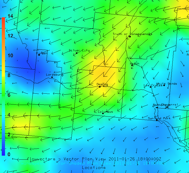
Jan. 20 - Breezy early in the morning but calm during the day. The morning low at the NMSU coop site was 33F, 46 at the Las Cruces airport, and 47 in Deming. The 33 appears low but the climate center's low temperature reading low was 35.4F. The coop sensor is about 10 feet away from the climate center's sensor. The low at the Dripping Springs RAWS was 42F this morning. So this points toward a temperature inversion since the airport and RAWS stations are at higher elevations. Actually the low is going to be in the late evening since it's already in the 30s at 10 pm. The plot below shows predicted surface winds at 18 UTC (11 am) today.
The weather map shows the location of front at 18 UTC and corresponds to the higher surface wind speeds over northern Chihuahua.
It will start to cool off after a cold front slides through the region this afternoon. Particulates at the core site showed nothing out of the ordinary with a peak PM2.5 of 47 µg/m3 at 11 am.
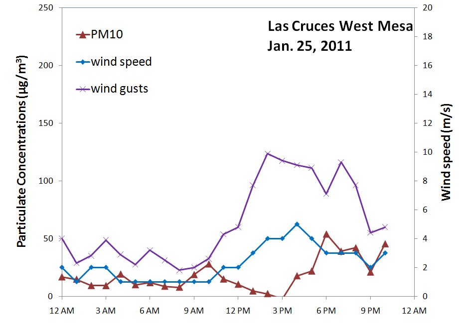
We saw a brief wind erosion event a the Sunland Park City Yard station this morning.
Good air quality at the Las Cruces Holman Road station.
A prescribed burn in the Coronado National Forest looked to bring in a little smoke (green shaded area) into Hidalgo County today. The fire is on the west slopes of the Chiricahua Mountains burning about 750 acres of grass and brush today. The spot forecast called for light southeast (coming from SE) winds at 20-foot. The smoke plume however is entrained in the winds aloft that carries it eastward.
At 00 UTC (5 pm) winds aloft at 700 mb (about 10,000 ft above sea level) were from the west as the map below shows. Wind streamlines in this map were from the 00 UTC run of the NAM model at 80-km.
We observe this decoupling of the lower boundary layer with the free troposphere in the 00Z sounding at Santa Teresa. The base of an inversion is around the 700 mb pressure level and above that is a very dry layer with a mixing ratio down to 0.05 g/kg that is 50X less than at the surface.
One last point I'll make on this frontal event is to show the Deming radar wind profiler wind ladders for today. You can see the drastic wind shear and veering of the surface winds compared to those aloft. The break is right around a height of 2.5 km above sea level or about 1.2 km above the ground. This is what makes it so much fun.

Time lapse camera from NMSU shows our clear skies after a cloudy morning. You can see the winds are from the west at the cloud level.

Wednesday, January 19, 2011

Jan. 19 - Winds was the major story today. Low was 33F and high temperature at NMSU was 71F. Below is the RUC surface wind forecast for 20 UTC (1 pm MST) today. Based on this we would likely see some blowing dust today in our region.
The NWS forecast for Las Cruces is for a "west wind 14 to 17 mph increasing to between 23 and 26 mph. Winds could gust as high as 36 mph." In the morning we saw some high clouds over northern Chihuahua but sunny over the rest of the region. We saw another strong inversion taken at the Santa Teresa NWS office. this morning.
The morning winds were low so we saw some low wind stagnation at Anthony. There hourly PM10 was 128 µg/m3 and PM2.5 is 18 µg/m3 during the 8 am measurement hour.

At the NMSU core site we saw the highest PM10 at 2 pm with a peak hourly concentration of 216 µg/m3. Maximum winds during the event were 12.5 m/s (28 mph).
We saw peak PM10 at the Deming Airport occur at 2 pm with an hourly concentration of 120 µg/m3.
My campus cloud cam shows the event looking west.