
High clouds, dry conditions, and warm temperatures describe a nice Sunday. Below are this morning's observations at a couple NWS Cooperative weather stations.
Yesterday Today
Station High(F) Normal Low(F) Normal Record Low Precip
NMSU 57 58 26 27 12 (1963) 0.00"Antelope Wells 56 62 25 25 9 (2007) 0.00"
The AQI forecast for the region showed good air quality today.

Knowing that a low wind event was not likely I loaded up the Minvols up today to start at 6 pm tonight to capture a "normal" evening with winds from the southwest. Southwest winds would bring in particles from the community of Sunland Park and from the Santa Teresa border crossing area. I'm testing the Minivol batteries to see if they can run two 6-hour samples. If they can I may not swap them out and charge them everyday. I may run the samplers again tomorrow to get a high wind coarse particle and fugitive dust sample even though this is a low wind study. I also installed a 4 inch rain gauge in case there are some rain drops to collect during the next couple of days.
Update on the battery problem: The solar charge controller was not working and the deep cycle battery was discharged down to 2 volts. I had a spare battery in the truck that I swapped out for the dead one so the particle sizer is running again. Tomorrow I'll replace the controller and hopefully fix the problem. The discharged battery is in the shop under a charger to see if it can be brought back to life.
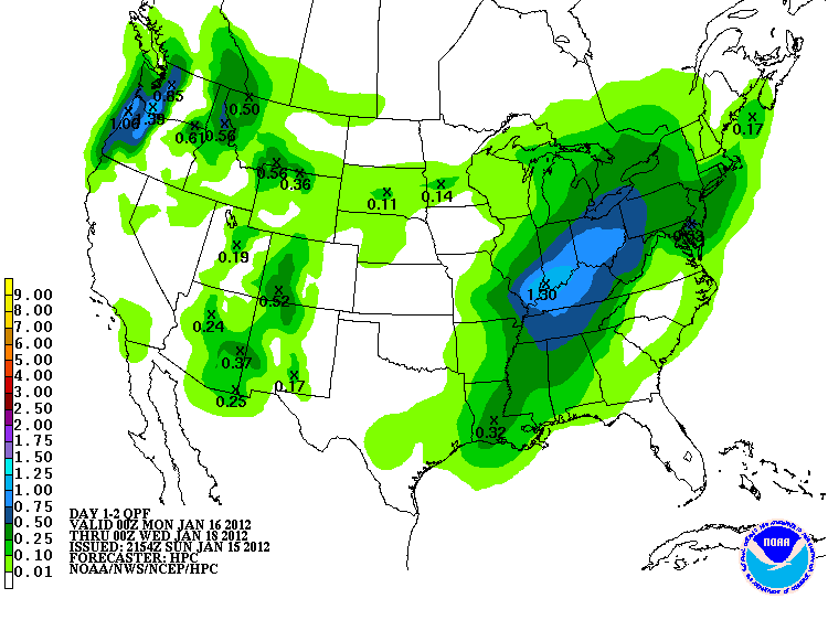
The big weather story is the winds forecasted for Monday. An upper level low pressure system moves into the area and winds are forecasted to peak in the 30 mph range with gusts up to 45 mph. The QPF product is showing a possibility of 0.01 to 0.10 inches of rain between now and Tuesday afternoon. More is possible in the Gila and Sacramento Mountains probably in the form of snow.
No comments:
Post a Comment