July 1 -
Wow, we are in July already. From the NOAA HMS smoke product we might be seeing some of the transported smoke from a Mexican fire today.
By late afternoon the far western border region had some convective storms pop up. Areas north of us fared better with precipitation today but our turn may be coming.
Temperatures didn't get as high today as the past few days but the dewpoint is climbing up and we're in the mid 30s to 40 around the region. Low level Hysplit backtrajectories from points in NM are from the Gulf of Mexico.
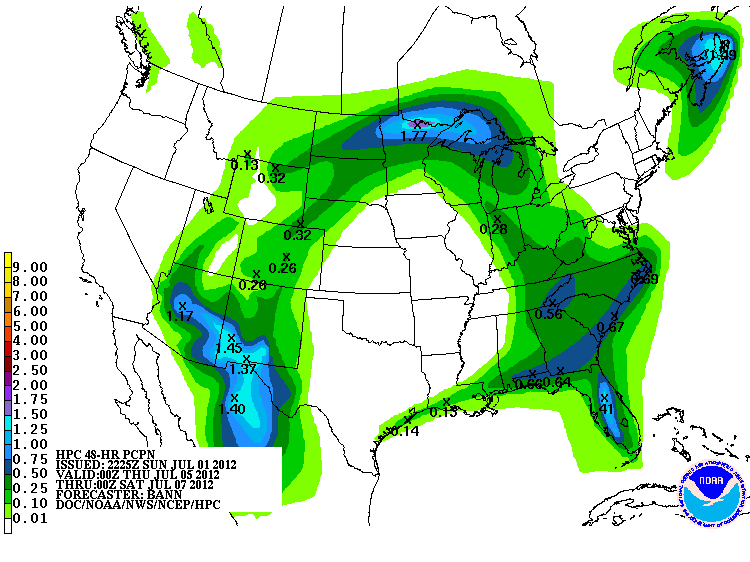
Welcoming us to July, I saw a promising 4-5 day QPF map for rain after the 4th. This looks to be a promising monsoon pattern with some impressive amounts.
The El Paso NWS office has been updating a nice daily climate
graphic for the airport. You can see the above normal temperatures this summer clearly in the graph. The green is the normal daily temperature variation, the red is the record highs, and the blue are the record lows.


No comments:
Post a Comment