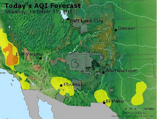
The AQI forecast for today shows an area of moderate air quality in southern New Mexico on around the Paso del Norte.
Last night I saw a moderate low wind episode at the southern NMED PM stations. The Sunland City Yard station recorded a peak PM10 concentration of 351 µg/m3 at 6 pm. PM2.5 was 61 µg/m3 at the time. We will probably expect to see more of them tomorrow morning as the ground cools and sets up a strong stable layer.
A haboob rushed through eastern NM in the afternoon bringing in low visibilities and thick dust. Below is a snapshot at 23UTC (5 pm) showing the dust cloud along an arc in the middle of the image. Vectors are from the 20-km RUC surface winds at 23 UTC.


No comments:
Post a Comment