Saturday, June 30, 2012

June 30 -

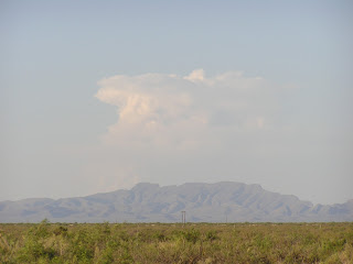
End of another month and unfortunately a state fiscal year. I've been polishing up reports that should have been done at lot sooner.  We saw some very light precipitation fall in the Mesilla Valley this afternoon but not enough to do any real good except to cool things down and reduce ET a bit. By 6 pm we had all of the SW corner of NM covered in convective clouds. Based on radar precipitation estimates the only significant rain fell over the Gila.
This is a year of extreme weather events with Derecho blowing through the Midwest and finally exiting the US off the east coast. I know other areas were hit but parts of south Jersey were impacted hard.  I was there last month and they are still rebuilding bridges from the last flood with a few roads still closed.  From this storm power is not expected to be back up until July 6 in the rural farm area where my folks are.  However people in that area are used to that kind of schedule. Most everyone has at least one or two generators to power things. Two of the fatalities from the storm occurred close to where I grew up. I'm very familiar with the location where the two kids were killed and my heart goes out to the families.

Friday, June 29, 2012

June 29 -

Another warm day but some of us got a little relief from the heat with a brief afternoon thunderstorm.  Here in Las Cruces we didn't receive any measurable precipitation except for a few drops.  I just happened to look out the window and noticed what looked like a dust devil.  After consulting with the National Weather Service, who were on campus for an outdoor concert, we decided it was a gustnado that rolled across Mesilla, NM this afternoon as thunderstorms developed over the Mesilla Valley.

Thursday, June 28, 2012

June 28 -

I'm back in town after a quick trip to Santa Fe for a meeting with the Drought Task Force. The Task Force is now meeting quarterly from the Governor's directive. Lots of good topics discussed at the meeting. I'm a little surprised that there were not that many from the public at the meeting. Maybe it is not that well publicized. The agenda is published on the Office of State Engineer's website but I think we can improve to get the word out. Also it is during the work day from 9 am to noon.

Looking at the NOAA HMS product for this evening more than half of the continental US is covered to some degree with smoke.
There was some nice convective clouds with some precipitation around the Jemez and Manzano Mountains but it didn't look like a lot.  I stopped by the Los Lunas Ag Science Center and did a couple of minor adjustments to our weather station. It was hot there this afternoon and not at all fun to be out in the sun.

Driving back from SF this afternoon I noticed a little above average haze in southern NM. It shouldn't surprise me with all the fires in the west and the stagnation. Dewpoints are still low in the 30s so the RH is very low with all the heat. Below is the Navy Aerosol Model for today. In comparison to the HMS product above it shows smoke present at the surface throughout the southwest.
Tomorrow's air quality forecast shows a moderate level in and around the Paso del Norte due to ozone. The summer ozone season is hitting the eastern US hard with large areas of orange "unhealthy for sensitive groups" and spots of "unhealthy" showing up in red.

Sunday, June 24, 2012

June 24 -

No relief from the heat today but we have seen relief from wildfires burning in the region. The NOAA HMS product shows no smoke plume outlines over the border region. We still see fires burning in the Chihuahua Mexico and the Sawmill fire west of Socorro. The Whitewater-Baldy complex in the Gila is 87% contained and the Little Bear fire is 90% contained.

Saturday, June 23, 2012

June 23 -

I saw a glimpse of the Sawmill fire from my driver from Albuquerque to Las Cruces this afternoon. I took this from the San Marcial exit on I-25 around 5 pm. This fire is 12.5 miles south of Magdelena and smoke plume was visible from Socorro today.
NM Fire Info shows another fire in the Gila today. I didn't get an area burned for the Diamond fire but it is 39 miles NE of Silver City. The map below shows these two fires and a couple in Mexico producing some smoke in the border area.


Wednesday, June 20, 2012

June 20-

It's been a while since I last posted. It has been hard to get a few minutes to summarize what's happening outside. We've as a drought workgroup have been planning on a webinar to communicate the impacts of the drought in NM and forecasts. The webinar is for Friday June 22 starting at 1:30 pm MDT.It's open to anyone and all you have to do it sign up.

I saw a little more than normal haze this morning here in Las Cruces. With the numerous wildfires in NM, AZ, CO and a high pressure system it is no surprise. The NM wildfires are winding down but still generating smoke especially in the late afternoon. The NOAA HMS smoke product at 11 am today showed a widespread swath of smoke over much of southern and eastern NM and extending out toward the upper midwest.
The EPA/NOAA forecast for 8-hour ozone shows peak concentrations around 7 pm tonight. Below is a map of 8-hr ozone for 02UTC tonight.The model is showing higher ozone concentrations just south of Deming and southeast of El Paso.
Only a slight chance for precipitation on the western edge of the border region over the next 5 days. The QPF map below shows a possibility for rain Friday night and into Saturday.


Friday, June 15, 2012

June 15 -

Finally a chance of some rain along the border!  The convection this afternoon came up quick.
It's been a very busy week with reporting, budgets, planning, etc. and not much extra time for blogging. Sorry. I've been planning a drought webinar for next Friday on top of the usual NM Drought Monitoring Workgroup meeting on the same day. The webinar should be good with speakers from NWS ABQ, TUC, EPZ, and experimental forecast from NOAA Boulder.

Monday, June 11, 2012

June 11 -

Southwest winds should transport smoke plumes toward the northeast today from the Gila, Little Bear, and Mexican fires today. Depending on the activity of the fires in the Sierra Madres in Mexico it is possible to see impacts from this. Below are this morning's 12UTC HYSPLIT forward trajectory predictions for today. The red lines are airmasses starting at 500 meters and the green ones begin at 1500 meters above the ground.
I'm not seeing precipitation relief for the ongoing fires in NM based on this morning's 5-day QPF.


Sunday, June 10, 2012

June 10 -

I got back from a weekend at Kingston, NM on the eastern edge of the Black Mountains today. There were no impacts of smoke from Friday to Sunday. I talked to folks living in the area and they said that they received minimal smoke from the Gila fire.  On the way there on Friday evening I saw a brief pyrocumulus cloud formation just before sunset from the Little Bear fire in the Sacramento Mountains. Below is a shot of the Little Bear plume around 7 pm on Friday as seen from the Upham exit on I-25. By the time I could pull over it was starting to dissipate but I captured part of it.
Stopping at Caballo Dam on Friday evening before heading west of highway 152, I snapped a photo of the Whitewater-Baldy smoke plume looking north. Most of the plume looked to be elevated but some appeared to be reaching the ground.
We could see some visibility impacts from the fires in the Sierra Madres of Mexico today. Based on the wind forecasts, I see no impacts of smoke from the Gila fire in our area. Below shows an afternoon image from GOES (courtesy of NCAR). The smoke plume from the Little Bear fire dominates over other fires today.
Today's backtrajectories from NOAA showed that smoke from the Mexican fires could impact our area today. The following map shows backtrajectories from Las Cruces, Silver City, Mayhill, and Ft. Davis, TX.

Friday, June 8, 2012

June 8 -

Below is a map showing backtrajectories from several locations to help determine the impacts of wildfire smoke on our area. The backtrajectories are for early this morning at 5 am. The forecast is for southwest winds today and as a result not expecting smoke from the Gila fire to impact the border region.

Tuesday, June 5, 2012

June 5 -

Smoke impacts from the Whitewater-Baldy fire on the border region are minimal today.  The forecast for smoke is similar to yesterday with localized impacts near the fire with transport due to downslope and downvalley winds.  Winds are expected to be from the southwest to transport winds toward the northeast.  Yesterday afternoon, smoke was visible mainly near the fire. Below shows a MODIS image from the Aqua satellite. Red dots show the location of the active burning areas yesterday.
As of 10 am today hourly PM2.5 was low in Las Cruces, averaging less than 10 µg/m3. Yesterday the concentrations spiked up to 33 µg/m3 before the winds transported some of the haze out the valley. Below shows PM2.5 concentrations measured at the NMSU Fabian Garcia farm from yesterday to 10 am today.
Today's AQI forecast for the region shows an area of moderate over the Paso del Norte and El Paso county. This is due to ozone.

Sunday, June 3, 2012

June 3 -

I've been away out of town all of last week and now just getting back up to speed on things I missed.  I drove in from ABQ today and noticed smoke from the Gila fire worsening starting around the Derry/Arrey exit on I-25. I saw very little haze in the Albuquerque area in the morning. The NOAA GASP aerosol product showed the smoke plume moving west across the state today.
 
From the NOAA HMS smoke product from this evening, smoke is widespread across most of NM.
 The forecast for Monday is showing northwest winds at the surface and lower elevations and will likely bring in additional smoke in the border region.